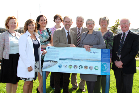
TEN detailed information panels have been installed at sites around the Lecale coast to add to people’s enjoyment of the Strangford and Lecale Area of Outstanding Natural Beauty by the Strangford Lough and Lecale Partnership.
South Down MP Margaret Ritchie officially launched the panels Thursday (6 September ) and said: “The Lecale has many tourist attractions, in the form of natural and built heritage and its unique Christian heritage. We must all work together to bring about the full potential of our tourism assets for the benefit of the community. The Area of Outstanding Natural Beauty designation, the work of the Strangford Lough and Lecale Partnership and the work of Down District Council is helping to make this a real destination. I welcome these information panels as a positive step in celebrating this area’s heritage for local people and visitors alike.”

Following the amalgamation of the Strangford Lough AONB with Lecale AONB, the Partnership extended its ‘Out and About’ booklet and panels to take in key sites around the Lecale coast. Both booklet and panels have been funded by the Northern Ireland Environment Agency, the National Trust, Down District and Ards Borough Councils.
Packed full of factual information, colourful pictures, species identification and labelled panoramic pictures, the panels are intended to help people ‘read the landscape’.
Chairperson of the SLLP Advisory Committee, Isabel Hood, said: “The panels are just one of the many strategic initiatives developed through the Partnership to promote and conserve this area’s heritage. We warmly thank the many local people who contributed to the ‘Out and About’ booklet and panels. Particular thanks go to local resident and environmentalist Bridget O’Neill who compiled and wrote most of the information.
“From the sandy beaches to rocky headlands, the landscape presents a wide range of vistas. And there is a rich history too ranging from St Patrick, through the Norman period up to the present day. The local economy has been much involved in farming and fishing. In the past there were windmills in the area, and now we have a sea generator in Strangford Lough. Mrs Hood described the project as encompassing complex natural history, social and economic areas.
Councillor Maria McCarthy, Vice Chairperson of Down District Council: said: “Down District Council is pleased to be a core member of the Strangford Lough and Lecale Partnership working closely with Northern Ireland Environment Agency, Ards Borough Council and an Advisory Committee of stakeholders,” said “Working together we can achieve a really integrated approach to manage this area’s rich heritage.”
Speaking at the lauch, SouthDown MLA Sean Rogers said: ” “.
The panels and the booklet aim to address many of the questions that people regularly raise, such as where the name Lecale comes from. It was known by the ancient name of Magh-Inis, ‘the island plain’. Historically Mag Inis was the core territory of the Dal Fiatach which had strong associations with the sea. Historical sources referred to this territory as Mag Inis until the early 9th Century although it was later known as Leath Cathail ‘Cathal’s half or division’ or Lecale.
The partnership is keen to meet with community groups and residents of Lecale over the coming months, and will hold a number of events and present online features to celebrate the area’s heritage. These include a shore exploration with David Thompson from the National Trust on Saturday 29 September and a walking talk on the town of Ardglass by Michael Howland (date to be confirmed). SLLP also hope to collate images of the area taken by local people.
Please call the Partnership on 02842 728886 for details.
The Lecale panels can be found at some of the area’s main stopping points: Audley’s Castle, Strangford, Cloghy Rocks, Kilclief, Killard, Ballyhornan, Ardglass, Killough, Rossglass, and Slieve Patrick.
Lots more on Lecale can be found at http://www.strangfordlough.org/


